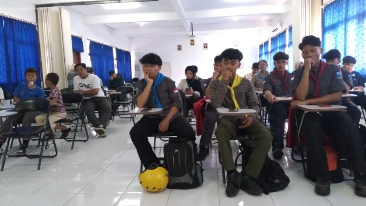
TASIKMALAYA, Thecuy.com – The potential for cave exploration in Tasikmalaya is considered to have great prospects for further development. It is not only a free‑range adventure activity, but cave exploration can also become a field of study that offers benefits for education, research, environmental conservation, and even industry.
Salah satu aspek yang menjadi perhatian adalah teknik pemetaan gua, atau yang dikenal sebagai cave mapping.
Keahlian ini dinilai penting untuk mengidentifikasi kondisi kawasan bawah tanah, memahami ciri lorong gua, dan mendukung perlindungan ekosistem karst.
What does GERINDRA need KDM for? The dark horse of Gerindra!

Efforts to showcase this potential were realized through the All About Caving IV event, titled Civilization Summit – Cave Mapping, initiated by the Tasik Caving Community (TCC) in collaboration with Muhammadiyah University of Tasikmalaya (UMTAS) and Mapala. The activity took place at UMTAS Campus, Tasikmalaya City, on Saturday (7/11/2026).
Ketua Pelaksana Cepi Sandra Wijaya, S.Sos., stated that the activity is part of an effort to broaden public awareness about the benefits of cave exploration and mapping.
In his opinion, caving activities have often been seen only as adventure pursuits. However, behind these activities lies a scientific aspect that can be developed and utilized for various purposes.
“Through this activity, we aim to introduce that cave exploration is not merely an adventure activity, but also holds scientific value and practical benefits that can be developed in the fields of education and profession,” said Cepi.
He explained that cave mapping is linked to various scientific disciplines, ranging from geography, geology, history, archaeology, mathematics, geometry, to biology. Therefore, the activity can serve as a field learning medium for students to develop analytical skills, data collection, and direct understanding of environmental conditions.
“Students and academics have opportunities to use cave areas as research subjects, especially in the fields of geography, geodesy engineering, archaeology, and biology,” he said.
In addition to supporting research, cave mapping also holds significant value in preserving environmental sustainability. The generated data can be utilized to study karst hydrological systems, the presence of groundwater sources, and the condition of ecosystems within caves.
Reading Amir Mahpud’s maneuver: Herdiat‑Dony for 2029, where is KDM heading? PKK cadres must be the front line, handling out‑of‑school children and waste management in Tasikmalaya City
Cepi added that this activity also offers lessons on teamwork, discipline, risk awareness, and understanding the importance of conserving karst areas.
Baca juga Berita lainnya di News Page
Terimakasih sudah mengunjungi thecuy . 🙂

Saya adalah jurnalis di thecuy.com yang fokus menghadirkan berita terkini, analisis mendalam, dan informasi terpercaya seputar perkembangan dunia finansial, bisnis, teknologi, dan isu-isu terkini yang relevan bagi pembaca Indonesia.
Sebagai jurnalis, saya berkomitmen untuk:
Menyajikan berita yang akurasi dan faktanya terverifikasi.
Menulis dengan bahasa yang mudah dipahami, namun tetap menjaga integritas jurnalistik.
Menghadirkan laporan mendalam yang memberi perspektif baru bagi pembaca.
Di thecuy.com, saya tidak hanya melaporkan berita, tetapi juga berupaya menganalisis tren agar pembaca dapat memahami konteks di balik setiap peristiwa.
📌 Bidang Liputan Utama:
Berita Terbaru & ekonomi, keuangan.
Perkembangan teknologi dan inovasi digital.
Tren bisnis dan investasi.
Misi saya adalah membantu pembaca mendapatkan informasi yang cepat, akurat, dan dapat dipercaya, sehingga mereka bisa membuat keputusan yang lebih cerdas dalam kehidupan sehari-hari maupun dunia usaha.
📞 Kontak
Untuk kerja sama media atau wawancara, silakan hubungi melalui halaman Kontak thecuy.com atau email langsung ke [email protected].