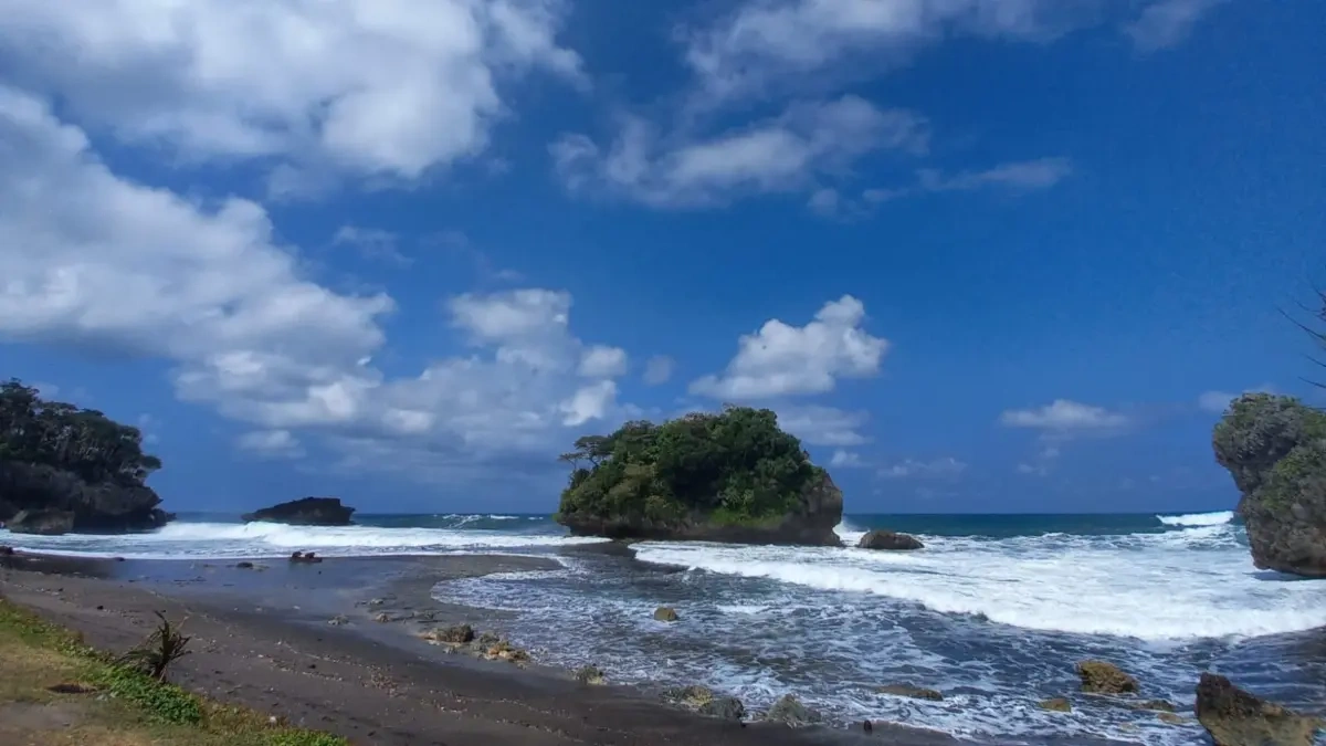
PANGANDARAN, Thecuy.com – The land dispute in Masawah Village, Cimerak District, continues to stir controversy. The case involves two former village officials who have since passed away.
Village head of Masawah, Ukan Suganda, said that the land claim problem has existed for a long time. The land is located in the Madasari tourism zone, which the village government plans to develop.
Information obtained indicates that the land certificate is registered under the names of two deceased individuals who previously held the positions of BPD Chairman and Dusun Head.
Don’t conduct superficial evaluations! Council urges Tasikmalaya Mayor to understand parking issues at the field where an LPG truck crashed in Pangandaran! Gas canisters were scattered on the road, resulting in the driver’s death.
“Both individuals held positions within the village administration at that time,” he said on Tuesday (18/8/2026).
The existence of a certificate registered under a private individual’s name subsequently raised questions for the village government, prompting them to investigate further.
“Our main question is, what is the basis for this land to be registered under a private individual’s name?” he clarified.
Thus far, no sale or transfer documents have been discovered to explain how the land certificate came to be registered under a private individual’s name.
The village has sought assistance from the National Land Agency (BPN) to confirm the land’s location. Ukan stated that, at that time, the village government had not obtained certainty regarding the exact location of the land as indicated in the certificate.
The matter resurfaced when Masawah Village participated in the Systematic Complete Land Registration (PTSL) program in 2026. During the measurement process, data on land plots linked to the certificate registered under a private individual’s name reappeared.
“There are two land plots with areas of approximately 8,000 square meters and 7,000 square meters. When combined, the total area is about 1.5 hectares,” he explained.
Former Tasikmalaya Mayor speaks on potential PAD! Dadaha parking revenue could reach 500 millionRevitalization of schools: Swakelola shouldn’t become a farce!
The discovery prompted the village government to verify whether the data in the land documents truly matches the actual conditions on the ground, including its consistency with the village block map and administrative records.
However, the Madasari issue does not end with land area and administrative matters. The area also holds historical significance for the local community, as it contains ancestral graves that have long been revered and considered part of the history of the Madasari community.
Ukan said that the community’s relationship with the area cannot be separated from the history of their ancestors. Any plans for utilization or relocation of the graves must consider historical aspects and respect for the community.
Read other news on the News Page.
Thank you for visiting thecuy 🙂

Saya adalah jurnalis di thecuy.com yang fokus menghadirkan berita terkini, analisis mendalam, dan informasi terpercaya seputar perkembangan dunia finansial, bisnis, teknologi, dan isu-isu terkini yang relevan bagi pembaca Indonesia.
Sebagai jurnalis, saya berkomitmen untuk:
Menyajikan berita yang akurasi dan faktanya terverifikasi.
Menulis dengan bahasa yang mudah dipahami, namun tetap menjaga integritas jurnalistik.
Menghadirkan laporan mendalam yang memberi perspektif baru bagi pembaca.
Di thecuy.com, saya tidak hanya melaporkan berita, tetapi juga berupaya menganalisis tren agar pembaca dapat memahami konteks di balik setiap peristiwa.
📌 Bidang Liputan Utama:
Berita Terbaru & ekonomi, keuangan.
Perkembangan teknologi dan inovasi digital.
Tren bisnis dan investasi.
Misi saya adalah membantu pembaca mendapatkan informasi yang cepat, akurat, dan dapat dipercaya, sehingga mereka bisa membuat keputusan yang lebih cerdas dalam kehidupan sehari-hari maupun dunia usaha.
📞 Kontak
Untuk kerja sama media atau wawancara, silakan hubungi melalui halaman Kontak thecuy.com atau email langsung ke [email protected].